A hydrogeological conceptual site model (CSM) is a description of various natural and anthropogenic factors that govern and contribute to the movement of groundwater in the subsurface. Simply put, it is the answer to the following key questions:
- Where is the groundwater coming from?
- Through what type of porous media is it flowing?
- How much of it is there, and how fast is it flowing?
- Where is it going?
- How did the groundwater system behave in the past, and how will it change in the future based on both natural and anthropogenic influences?
When the groundwater is contaminated, a CSM also includes answers to similar general questions regarding the contaminant(s). An accurate CSM is critical in satisfying the goal of any project, which, in hydrogeological practice, typically involves a decision regarding water supply, protection of human health and the environment, or both (Kresic and Mikszewski, 2013).
ASTM International (2008), formerly the American Society for Testing and Materials, defines a conceptual site model for contaminated sites as follows: “A written or pictorial representation of an environmental system and the biological, physical, and chemical processes that determine the transport of contaminants from sources through environmental media to environmental receptors within the system.”
This traditional definition of a CSM is essentially a qualitative one, emphasizing its visual (“pictorial”) and narrative aspects. However, the basis for all common CMS visualizations is quantitative, starting with the spatial coordinates of collected site data/parameters (whatever they may be) and their discrete values in three-dimensional space, and ending with a series of georeferenced maps, cross-sections, and 3D-diagrams, as well as graphs (e.g., hydrographs) of their observed spatial and temporal changes.

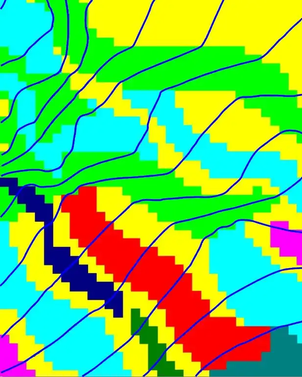
Fig. 1 Distribution of interpolated values of hydraulic conductivity in a numeric model
All this quantitative information is basis for answering the most important, quantitative question for just about any groundwater project as cited above: How will the groundwater system change in the future based on both natural and anthropogenic influences?
A few examples from everyday practice immediately come to mind: how much groundwater can we pump and what will be the influence of this pumping? What will happen to the contaminant concentrations if we “don’t do anything” vs. “doing something” (e.g., implementing a bioremediation remedy, or injecting reactive fluids to destroy the contaminant, and similar).

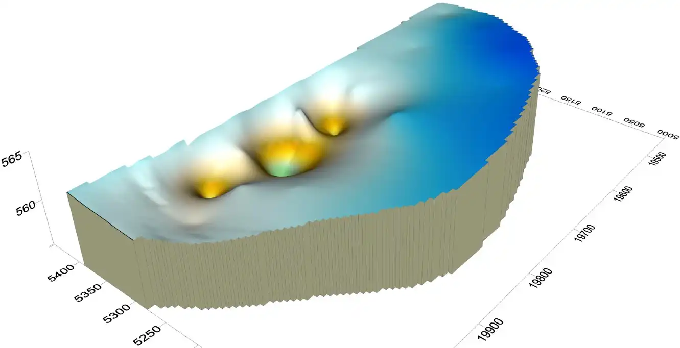
Fig. 2 Model-simulated drawdown by three extraction wells pumping near a river
Groundwater models, and numeric models in particular, are the best available means of simulating these interventions and most simply, determining if they will work. In modern hydrogeology, a quantitative CSM and a numeric groundwater model are developed simultaneously and are considered as one unifying platform.
One key reason to conduct groundwater modeling very early on is that 3D numerical models help the hydrogeologist truly understand physical and chemical processes occurring at a site. The hydrogeologist can use a groundwater model to create a numeric (quantitative) representation of the CSM and effectively put it to the test.
The conceptual interpretation of geology, surface water–groundwater interaction, and flow-boundary conditions become the input to the model. The ability of the model to match measurements of the hydraulic head and contaminant concentration at monitoring wells, stream flow, and other parameters is an indicator of the strength of the underlying CSM.
Ideally, the hydrogeologist’s model will become a valuable instructional tool in identifying data gaps or components of the CSM that are more critical than previously imagined. Therefore, the CSM is refined as the numeric modeling is being conducted and refined as well.

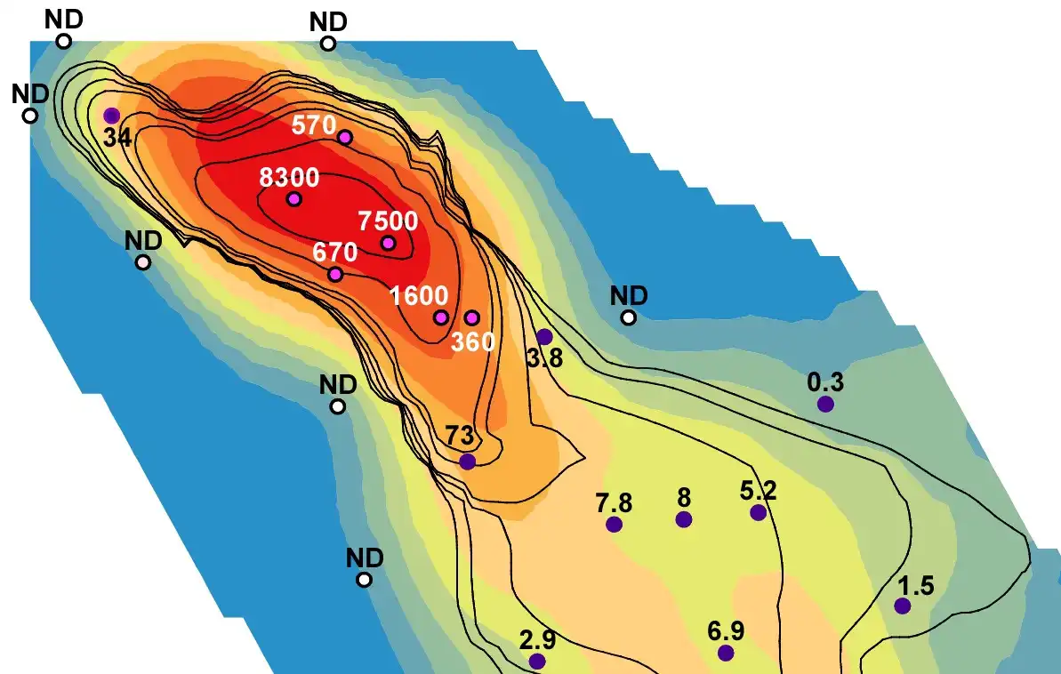
Fig.3 Observed and interpolated groundwater contaminant concentrations ready for import into a numeric model
In a sense, something of a chicken or an egg dilemma exists. The hydrogeologist needs a CSM to create a groundwater model to formulate model layers, boundary conditions, and hydraulic and chemical parameters for example. Yet the hydrogeologist will inevitably discover something new about the site through the execution of the groundwater model and will likely alter the CSM accordingly.
The explanation for this iterative behavior is that the initial CSM is usually developed with coarse resolution and focuses on macro concepts such as general soil (rock) type, stratigraphic relationships, general groundwater chemistry, and aquifer production potential.
When these broad categorizations are translated into a transient, site-specific numerical model, the many details involved in groundwater flow and contaminant transport become significant at a more refined scale. Changes in model layering or key parameters such as groundwater recharge or hydraulic conductivity become necessary, and often a conceptual justification for these changes exists that initially escaped the coarse resolution of the CSM.
The groundwater model and the CSM work hand-in-hand to create a 3D simulation of the real world, which the hydrogeologist can use to predict future conditions and explain how current conditions came to be (Kresic and Mikszewski, 2013.)
Cited literature
Kresic, N., and Mikszewski A., 2013. Hydrogeological Conceptual Site Models: Data Analysis and Visualizations. CRC/Taylor & Francis, New York, Boca Raton, FL, 584 p.
ASTM International, 2008. Standard Guide for Developing Conceptual Site Models for Contaminated Sites. E 1689-95, West Conshohocken, PA, 8 p.
